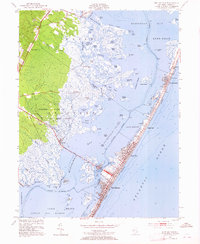
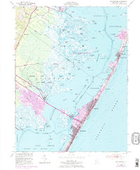
1952 Map of Ship Bottom
USGS Topo · Published 1965About this map
Long Beach stands as a dense ribbon of coastal development between the Atlantic and Barnegat Bay in this mid-century survey. The barrier island is heavily subdivided, showing the established footprints of Ship Bottom, Surf City, and Harvey Cedars connected by the island's primary north-south thoroughfare. The Manahawkin Bridge provides the vital link from the mainland, crossing Bonnet Island and Bay Side to reach the shore.
Find a feature on this map
72 named features on this map. Tap any name to fly to it.
Don’t see what you’re looking for? This feature index may not catch every label — zoom into the map to look around manually.
Map Details
Editions of this 1952 Ship Bottom Map
5 editions found
Other maps of this area

1884 · Whitings
USGS Topo · 1:62,500

1888 · Barnegat
USGS Topo · 1:62,500

1888 · Little Egg Harbor
USGS Topo · 1:62,500

1888 · Long Beach
USGS Topo · 1:62,500

1888 · Whitings
USGS Topo · 1:62,500

1893 · Little Egg Harbor
USGS Topo · 1:62,500

1893 · Long Beach
USGS Topo · 1:62,500

1893 · Barnegat
USGS Topo · 1:62,500

1898 · Barnegat
USGS Topo · 1:62,500

1919 · Long Beach
USGS Topo · 1:62,500
Featured Places
- Stafford Township, NJ
- Barnegat Township, NJ
- Long Beach Township, NJ
- Eagleswood Township, NJ
- Surf City, NJ