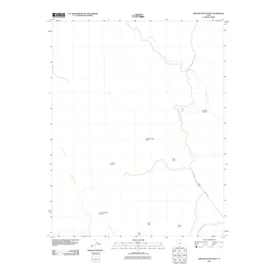
2011 Map of Ship Mountain Point
USGS Topo · Published 2011About this map
Glen Canyon National Park encompasses much of this landscape, where the high desert terrain is defined by dramatic geological features and winding drainages. High points such as Ship Mountain Point and Pilot Knoll provide significant landmarks for orientation across this stretch of Kane County. The map details the complex drainage patterns of Last Chance Creek and North Branch Creek, which have carved deep paths like Dry Fork Wesses Canyon and Drip Tank Canyon into the plateau. Two primary desert tracks, Smoky Mtn Rd and Smoky Hollow Rd, provide the only vehicle access through the southern portion of the area. Grounded features like Wesses Cove and Pilot Rock highlight the specific topographical identity of this region within the national park system during the early 21st century.
Find a feature on this map
15 named features on this map. Tap any name to fly to it.
Don’t see what you’re looking for? This feature index may not catch every label — zoom into the map to look around manually.
Map Details
Editions of this 2011 Ship Mountain Point Map
This is the sole edition of this map. No revisions or reprints were ever made.
Other maps of this area

1886 · Escalante
USGS Topo · 1:250,000

1922 · Warm Creek
USGS Topo · 1:63,360

1922 · Upper Last Chance
USGS Topo · 1:63,360

1922 · Rees Canyon
USGS Topo · 1:63,360

1953 · Nipple Butte
USGS Topo · 1:62,500

1953 · Gunsight Butte
USGS Topo · 1:62,500

1956 · Escalante
USGS Topo · 1:250,000

1960 · Escalante
USGS Topo · 1:250,000

1968 · Fourmile Bench
USGS Topo · 1:24,000
1968 · Petes Cove
USGS Topo · 1:24,000