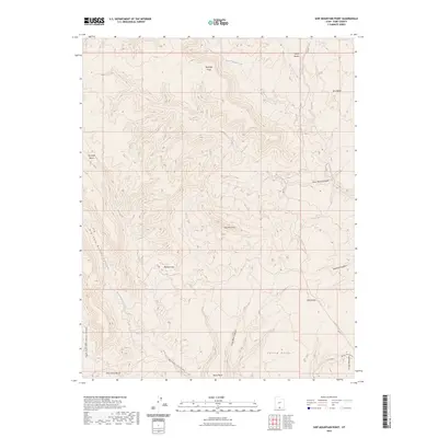
2023 Map of Ship Mountain Point
USGS Topo · Published 2023About this map
Ship Mtn Point stands as a central topographic anchor in this portion of the Kane County backcountry, where the high plateaus break into a complex system of canyons and benches. The landscape is defined by the drainage patterns of Last Chance Creek and the North Branch Creek, which have carved out deep recesses such as Drip Tank Canyon and Whities Canyon. Evidence of human passage through this arid terrain is marked by the Smoky Mountain Road Trl CO RD, a route that traverses the eastern edge of the map, passing landmarks like Pilot Knoll and the Drip Tank.
Find a feature on this map
22 named features on this map. Tap any name to fly to it.
Don’t see what you’re looking for? This feature index may not catch every label — zoom into the map to look around manually.
Map Details
Editions of this 2023 Ship Mountain Point Map
This is the sole edition of this map. No revisions or reprints were ever made.
Other maps of this area

1886 · Escalante
USGS Topo · 1:250,000

1922 · Warm Creek
USGS Topo · 1:63,360

1922 · Upper Last Chance
USGS Topo · 1:63,360

1922 · Rees Canyon
USGS Topo · 1:63,360

1953 · Nipple Butte
USGS Topo · 1:62,500

1953 · Gunsight Butte
USGS Topo · 1:62,500

1956 · Escalante
USGS Topo · 1:250,000

1960 · Escalante
USGS Topo · 1:250,000

1968 · Fourmile Bench
USGS Topo · 1:24,000
1968 · Petes Cove
USGS Topo · 1:24,000