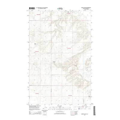
2014 Map of Shippe Canyon
USGS Topo · Published 2014About this map
Shippe Canyon and the surrounding high plains of Sheridan County are defined by a complex network of drainage ravines and local roads. This northern Montana landscape is etched by Richardson Coulee and Clarence Coulee, which channel seasonal runoff toward the more substantial Big Muddy Creek. The terrain shows the characteristic grid of the Public Land Survey System, with sections demarcated by a utilitarian road network that includes Shippe Canyon Rd and Singletree Rd. While largely unpopulated, the naming of features like Tower Hill Rd and Crazy Horse Rd suggests the local importance of specific topographic markers in this expansive grazing and agricultural region. The intermittent flow of Otter Cr further illustrates the semi-arid nature of the plains in this part of the Fort Kipp District.
Find a feature on this map
20 named features on this map. Tap any name to fly to it.
Don’t see what you’re looking for? This feature index may not catch every label — zoom into the map to look around manually.
Map Details
Editions of this 2014 Shippe Canyon Map
This is the sole edition of this map. No revisions or reprints were ever made.
Other maps of this area

1948 · Reserve
USGS Topo · 1:24,000

1948 · Alkali Coulee
USGS Topo · 1:24,000

1948 · Antelope
USGS Topo · 1:24,000

1949 · Reserve
USGS Topo · 1:24,000

1949 · Antelope
USGS Topo · 1:24,000

1949 · Alkali Coulee
USGS Topo · 1:24,000

1950 · Shippe Canyon
USGS Topo · 1:24,000

1954 · Wolf Point
USGS Topo · 1:250,000

1958 · Wolf Point
USGS Topo · 1:250,000

1983 · Dooley SW
USGS Topo · 1:24,000