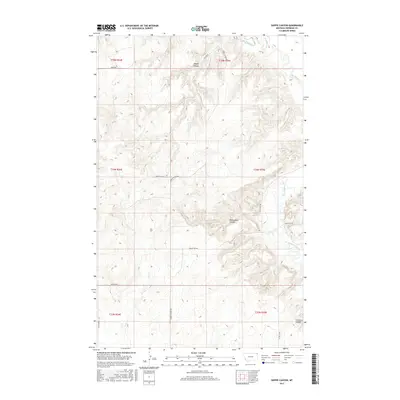
2017 Map of Shippe Canyon
USGS Topo · Published 2017About this map
Big Muddy Creek winds through the eastern edge of this Sheridan County landscape, where the prairie is deeply incised by a network of drainage features. The terrain is defined by dramatic erosional formations, including the prominent Shippe Canyon in the north and the broad Richardson Coulee further south. These coulees and canyons serve as the primary topographical landmarks in an otherwise open rangeland, dictating the placement of rural infrastructure.
Find a feature on this map
22 named features on this map. Tap any name to fly to it.
Don’t see what you’re looking for? This feature index may not catch every label — zoom into the map to look around manually.
Map Details
Editions of this 2017 Shippe Canyon Map
This is the sole edition of this map. No revisions or reprints were ever made.
Other maps of this area

1948 · Reserve
USGS Topo · 1:24,000

1948 · Alkali Coulee
USGS Topo · 1:24,000

1948 · Antelope
USGS Topo · 1:24,000

1949 · Reserve
USGS Topo · 1:24,000

1949 · Antelope
USGS Topo · 1:24,000

1949 · Alkali Coulee
USGS Topo · 1:24,000

1950 · Shippe Canyon
USGS Topo · 1:24,000

1954 · Wolf Point
USGS Topo · 1:250,000

1958 · Wolf Point
USGS Topo · 1:250,000

1983 · Dooley SW
USGS Topo · 1:24,000