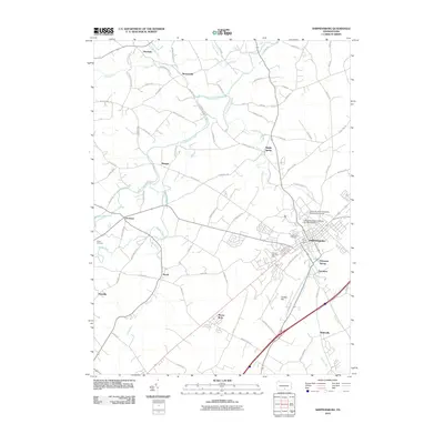
2010 Map of Shippensburg
USGS Topo · Published 2010About this map
Shippensburg serves as the focal point of this South Mountain region, where the campus of Shippensburg University of Pennsylvania and the local community meet. The landscape is defined by the winding course of Conodoguinet Creek and its many tributaries, including Middle Spring Creek and Rowe Run. The settlement pattern reflects a deeply rooted agricultural and institutional history, with small clusters like Middle Spring, Orrstown, and Pinola dotting the countryside. Genealogists will find significant value in the mapped locations of Middle Spring Church and Spring Hill Cemetery, alongside smaller family-named markers like Myers Cemetery. Transportation is anchored by the Norfolk Southern rail line and major thoroughfares like the Dream Hwy, which cut through a terrain of natural springs such as Dykeman Spring.
Find a feature on this map
83 named features on this map. Tap any name to fly to it.
Don’t see what you’re looking for? This feature index may not catch every label — zoom into the map to look around manually.
Map Details
Editions of this 2010 Shippensburg Map
This is the sole edition of this map. No revisions or reprints were ever made.
Other maps of this area

1902 · Chambersburg
USGS Topo · 1:62,500

1909 · Fairfield
USGS Topo · 1:62,500

1919 · Newville
USGS Topo · 1:62,500

1923 · Shippensburg
USGS Topo · 1:62,500

1942 · Hagerstown
USGS Topo · 1:125,000

1942 · Gettysburg
USGS Topo · 1:125,000

1943 · Hagerstown
USGS Topo · 1:125,000

1943 · Chambersburg
USGS Topo · 1:62,500

1943 · Shippensburg
USGS Topo · 1:62,500

1944 · Scotland
USGS Topo · 1:31,680