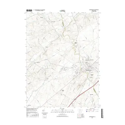
2016 Map of Shippensburg
USGS Topo · Published 2016About this map
Shippensburg sits at the heart of this valley landscape, anchored by the sprawling campus of Shippensburg University. The area's agricultural and institutional heritage is well-defined, where the boundaries of Franklin Co and Cumberland Co meet. Water plays a central role in the local geography, with Conodoguinet Creek winding through the northern reaches while Middle Spring Creek and Rowe Run drain the surrounding fields. Smaller historic clusters such as Orrstown, Middle Spring, and Mowersville appear as distinct rural junctions, often organized around creek crossings or road intersections. The map preserves the locations of local landmarks like Spring Hill Cem and the Veterans Memorial Park, alongside unique natural features like Dykeman Spring, illustrating a region where education, farming, and spring-fed waterways have long shaped the community layout.
Find a feature on this map
130 named features on this map. Tap any name to fly to it.
Don’t see what you’re looking for? This feature index may not catch every label — zoom into the map to look around manually.
Map Details
Editions of this 2016 Shippensburg Map
This is the sole edition of this map. No revisions or reprints were ever made.
Other maps of this area

1902 · Chambersburg
USGS Topo · 1:62,500

1909 · Fairfield
USGS Topo · 1:62,500

1919 · Newville
USGS Topo · 1:62,500

1923 · Shippensburg
USGS Topo · 1:62,500

1942 · Hagerstown
USGS Topo · 1:125,000

1942 · Gettysburg
USGS Topo · 1:125,000

1943 · Hagerstown
USGS Topo · 1:125,000

1943 · Chambersburg
USGS Topo · 1:62,500

1943 · Shippensburg
USGS Topo · 1:62,500

1944 · Scotland
USGS Topo · 1:31,680