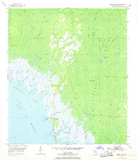
1955 Map of Shired Island
USGS Topo · Published 1968About this map
Shired Island stands at the edge of the Gulf of Mexico along a labyrinthine coastline of salt marshes and tidal creeks in the mid-1950s. The interior is dominated by the vast California Swamp, a dense wetland network where water bodies like California Lake and Thompson Lake are pocketed among the timber. A notable terrestrial feature is the Old Railroad Grade, which cuts through the southern swampy reaches, likely indicating former logging operations that extracted cypress or pine from these difficult coastal flats. Numerous small waterways, including Lilly Creek, Amason Creek, and Fishbone Creek, drain the limestone-underlaid landscape into Horseshoe Cove. The mapping of these drainages, from Shired Creek to Bumblebee Creek, provides an intricate look at the Gulf Coast's natural hydrology before modern coastal development.
Find a feature on this map
28 named features on this map. Tap any name to fly to it.
Don’t see what you’re looking for? This feature index may not catch every label — zoom into the map to look around manually.
Map Details
Editions of this 1955 Shired Island Map
3 editions found
Other maps of this area

1954 · Eugene
USGS Topo · 1:24,000

1954 · Steinhatchee SE
USGS Topo · 1:24,000

1954 · Cross City SW
USGS Topo · 1:24,000

1954 · Horseshoe Beach
USGS Topo · 1:24,000

1954 · Suwannee
USGS Topo · 1:24,000

1954 · Vista
USGS Topo · 1:24,000

1954 · East Pass
USGS Topo · 1:24,000

1954 · Gainesville
USGS Topo · 1:250,000

1955 · Shired Island
USGS Topo · 1:24,000

1958 · Gainesville
USGS Topo · 1:250,000