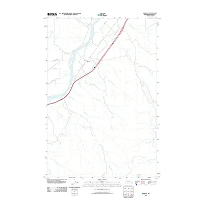
2011 Map of Shirley
USGS Topo · Published 2011About this map
The Yellowstone River cuts a wide path through this Custer County landscape, serving as the central geographic anchor for the small settlement of Shirley. This 2011 survey documents a territory defined by its water management and historic transit corridors, notably the Lewis and Clark Trl and the Kinsey Main Canal. The irrigation infrastructure provided by the canal system contrasts with the numerous natural intermittent drainages like Dead Horse Creek, Short Creek, and Hay Creek that etch the surrounding plains. To the southeast, the McFarland Reservoir represents a significant point of water storage for this arid region. The map captures the intersection of historical exploration routes and modern ranching or agricultural life, where roads like East Loop Rd provide access to the river's edge and the many creeks feeding into the Yellowstone basin.
Find a feature on this map
18 named features on this map. Tap any name to fly to it.
Don’t see what you’re looking for? This feature index may not catch every label — zoom into the map to look around manually.
Map Details
Editions of this 2011 Shirley Map
This is the sole edition of this map. No revisions or reprints were ever made.
Other maps of this area

1953 · Miles City
USGS Topo · 1:250,000

1957 · Miles City
USGS Topo · 1:250,000

1958 · Miles City
USGS Topo · 1:250,000

1969 · Corral Butte
USGS Topo · 1:24,000

1969 · Zero
USGS Topo · 1:24,000

1969 · Kinsey NE
USGS Topo · 1:24,000

1969 · Kinsey
USGS Topo · 1:24,000

1969 · Government Hill
USGS Topo · 1:24,000

1969 · The Knob
USGS Topo · 1:24,000

1969 · Buck Mountain
USGS Topo · 1:24,000