
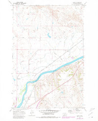
1969 Map of Kinsey
USGS Topo · Published 1973About this map
The Yellowstone River anchors this landscape in eastern Montana, where a sophisticated network of irrigation channels supported the rural community of Kinsey. The Main Kinsey Canal and specialized branches like the Middle Kinsey Canal and Lower Kinsey Canal illustrate the intensive hydraulic engineering required for prairie agriculture during the mid-20th century. This irrigation system is managed by the North Tongue and Yellowstone River Irrigation District Canal, providing a fascinating look at the infrastructure that sustained local ranching and farming operations.
Find a feature on this map
27 named features on this map. Tap any name to fly to it.
Don’t see what you’re looking for? This feature index may not catch every label — zoom into the map to look around manually.
Map Details
Editions of this 1969 Kinsey Map
2 editions found
Other maps of this area

1953 · Miles City
USGS Topo · 1:250,000

1957 · Miles City
USGS Topo · 1:250,000

1958 · Miles City
USGS Topo · 1:250,000

1968 · Miles City
USGS Topo · 1:24,000

1969 · Noble Reservoir
USGS Topo · 1:24,000

1969 · Kinsey NE
USGS Topo · 1:24,000
1969 · Coal Bank Spring
USGS Topo · 1:24,000

1969 · Government Hill
USGS Topo · 1:24,000

1969 · The Knob
USGS Topo · 1:24,000
1969 · Shirley
USGS Topo · 1:24,000