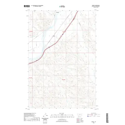
2020 Map of Shirley
USGS Topo · Published 2020About this map
The Yellowstone River defines the western edge of this Custer County landscape, where the settlements of Shirley and Bonfield sit along the river's eastern banks. This area showcases the transition from riparian commerce to the upland coulees and drainages typical of the region. The Kinsey Main Canal mirrors the river's path, indicating a managed water system essential for local agriculture. To the east, the terrain is carved by numerous seasonal drainages, including Dead Horse Cr, Miles Cr, and Charlie Cr, which flow through the dissected breaks toward the river valley. In the southern portion of the quadrangle, McFarland Reservoir and the split branches of Dixon Cr and N Dixon Cr highlight the reliance on small-scale water management in the drier Montana interior. Modern transportation corridors like W Old Highway 10 and Diamond Ring Rd provide access to these remote ranching and irrigation districts.
Find a feature on this map
27 named features on this map. Tap any name to fly to it.
Don’t see what you’re looking for? This feature index may not catch every label — zoom into the map to look around manually.
Map Details
Editions of this 2020 Shirley Map
This is the sole edition of this map. No revisions or reprints were ever made.
Other maps of this area

1953 · Miles City
USGS Topo · 1:250,000

1957 · Miles City
USGS Topo · 1:250,000

1958 · Miles City
USGS Topo · 1:250,000

1969 · Corral Butte
USGS Topo · 1:24,000

1969 · Zero
USGS Topo · 1:24,000

1969 · Kinsey NE
USGS Topo · 1:24,000

1969 · Kinsey
USGS Topo · 1:24,000

1969 · Government Hill
USGS Topo · 1:24,000

1969 · The Knob
USGS Topo · 1:24,000

1969 · Buck Mountain
USGS Topo · 1:24,000