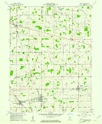
1960 Map of Shirley
USGS Topo · Published 1961About this map
Shirley sits at the tri-county junction of Madison, Hancock, and Henry counties, serving as a focal point for this agrarian landscape in the early 1960s. The town and nearby Wilkinson are linked by the New York Central railroad, which cuts a straight path across the southern portion of the map, also passing through Kennard. This corridor represents the area's primary industrial artery, while the surrounding townships of Adams, Fall Creek, Harrison, Brown, and Greensboro remain defined by a dense network of drainage ditches and small runs like Sixmile Creek, Sugar Creek, and Mott Run. Genealogists will find a wealth of specific landmarks, including several rural burial grounds such as Hess Cem, McCray Cem, and Collier Cem. The presence of the Township High Sch near Wilkinson and multiple community hubs like Center Chapel and Harlan Ch highlights the established social infrastructure of these small Indiana farming communities.
Find a feature on this map
58 named features on this map. Tap any name to fly to it.
Don’t see what you’re looking for? This feature index may not catch every label — zoom into the map to look around manually.
Map Details
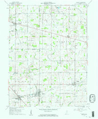
Editions of this 1960 Shirley Map
2 editions found
Other maps of this area

1949 · New Castle West
USGS Topo · 1:24,000

1950 · Dunreith
USGS Topo · 1:24,000

1952 · Anderson
USGS Topo · 1:24,000

1953 · Pendleton
USGS Topo · 1:24,000

1953 · Cincinnati
USGS Topo · 1:250,000

1953 · Muncie
USGS Topo · 1:250,000

1956 · Muncie
USGS Topo · 1:250,000

1956 · Cleveland
USGS Topo · 1:24,000

1957 · Cincinnati
USGS Topo · 1:250,000

1960 · New Castle West
USGS Topo · 1:24,000