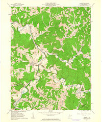
1961 Map of Shirley
USGS Topo · Published 1963About this map
Middle Island Creek and McElroy Creek carve through the deep ridges of Tyler County, defining a landscape of isolated homesteads and river-bottom communities in the early 1960s. The settlement of Centerville serves as a local hub, while smaller hamlets like Shirley, Josephs Mills, and Wilbur anchor the surrounding hollows. This survey captures a rural West Virginia economy transitioning between agricultural traditions and energy extraction, evidenced by the numerous Gas Wells and a Pumping Sta scattered among family landmarks. Genealogists will find significant detail in the placement of rural institutions such as Mt Moriah Ch, Spring Hill Cem, and the County 4H Camp. The map also documents specific land-use patterns, including a Quarry near McElroy Creek and a network of unimproved roads connecting farmsteads across Blue Ridge and Klondike Ridge.
Find a feature on this map
57 named features on this map. Tap any name to fly to it.
Don’t see what you’re looking for? This feature index may not catch every label — zoom into the map to look around manually.
Map Details
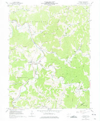
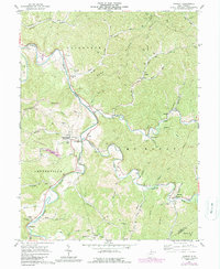
Editions of this 1961 Shirley Map
3 editions found
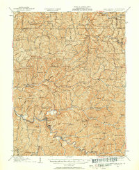
Other maps of this area

1903 · Littleton
USGS Topo · 1:62,500

1905 · Centerpoint
USGS Topo · 1:62,500

1905 · West Union
USGS Topo · 1:62,500

1905 · Littleton
USGS Topo · 1:62,500

1906 · New Martinsville
USGS Topo · 1:62,500

1924 · New Martinsville
USGS Topo · 1:62,500

1924 · Centerpoint
USGS Topo · 1:62,500
1924 · Littleton
USGS Topo · 1:62,500

1924 · West Union
USGS Topo · 1:62,500

1925 · Centerpoint
USGS Topo · 1:62,500