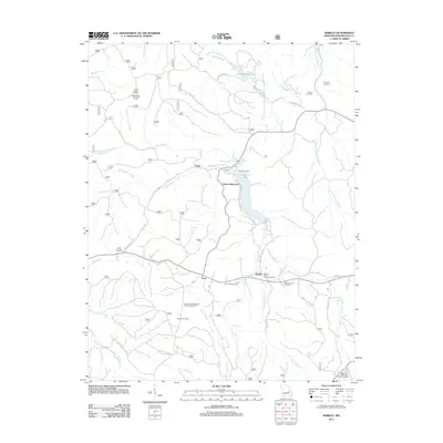
2011 Map of Shirley
USGS Topo · Published 2011About this map
Sunnen Lake serves as a central geographic feature in this part of Washington County, with Camp Lakewood situated along its northern shores. The surrounding landscape is defined by the branching tributaries of Fourche a Renault, including the Middle Fork Fourche a Renault and Little Fourche a Renault. Small clusters of activity are centered at Shirley, Levy, and Floyd, which are connected by a network of local roads such as Dunwoody Rd and Grassy Hollow Rd.
Find a feature on this map
41 named features on this map. Tap any name to fly to it.
Don’t see what you’re looking for? This feature index may not catch every label — zoom into the map to look around manually.
Map Details
Editions of this 2011 Shirley Map
This is the sole edition of this map. No revisions or reprints were ever made.
Other maps of this area

1901 · De Soto
USGS Topo · 1:125,000

1903 · Sullivan
USGS Topo · 1:125,000

1906 · Potosi
USGS Topo · 1:62,500

1943 · Berryman
USGS Topo · 1:62,500

1945 · Berryman
USGS Topo · 1:62,500

1946 · Richwoods
USGS Topo · 1:62,500

1947 · Sullivan
USGS Topo · 1:62,500

1948 · Richwoods
USGS Topo · 1:62,500

1949 · Saint Louis
USGS Topo · 1:250,000

1949 · Sullivan
USGS Topo · 1:62,500