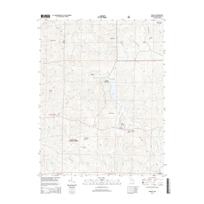
2015 Map of Shirley
USGS Topo · Published 2015About this map
Shirley and Floyd serve as the primary nodes of settlement in this pocket of Washington County, where the topography of the Saint Francois Mountains begins to shape the drainages of the Fourche a Renault. The landscape is notably dense with small family and community burial grounds, such as Stephens Cemetery and the Wilson Family Cemetery, indicating a long history of local kinship and dispersed rural homesteads. Significant recreational and conservation footprints are evident at Camp Lakewood on the shores of Sunnen Lake, while much of the southern portion of the map is managed as part of the Mark Twain National Forest. The drainage patterns of Little Fourche a Renault and Brazil Cr further define the intricate network of hollows, including Coffman Hollow, that characterize this region of the Ozarks.
Find a feature on this map
51 named features on this map. Tap any name to fly to it.
Don’t see what you’re looking for? This feature index may not catch every label — zoom into the map to look around manually.
Map Details
Editions of this 2015 Shirley Map
This is the sole edition of this map. No revisions or reprints were ever made.
Other maps of this area

1901 · De Soto
USGS Topo · 1:125,000

1903 · Sullivan
USGS Topo · 1:125,000

1906 · Potosi
USGS Topo · 1:62,500

1943 · Berryman
USGS Topo · 1:62,500

1945 · Berryman
USGS Topo · 1:62,500

1946 · Richwoods
USGS Topo · 1:62,500

1947 · Sullivan
USGS Topo · 1:62,500

1948 · Richwoods
USGS Topo · 1:62,500

1949 · Saint Louis
USGS Topo · 1:250,000

1949 · Sullivan
USGS Topo · 1:62,500