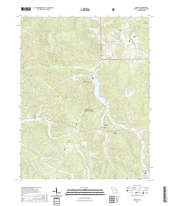
2021 Map of Shirley
USGS Topo · Published 2021About this map
Shirley and the recreational grounds of Camp Lakewood define the landscape of this Washington County study. The topography is dominated by the steep slopes of Little Pilot Knob and Montgomery Ridge, where numerous small watercourses like Brazil Cr and Scott Br feed into the larger Sunnen Lake. This area of the Mark Twain National Forest exhibits a dense concentration of local family history through its scattered burial grounds, including the Wilson Family Cem, Martin Cem, and Blount Cem. The rural settlement pattern is anchored by faith and family, centered on Shirley Union Church Cem and Grassy Hollow Baptist Church Cem. Transportation follows the winding valleys, with routes like State Hwy AA and Fourche Renault Rd tracing the natural contours of the Saint Francois Mountains.
Find a feature on this map
48 named features on this map. Tap any name to fly to it.
Don’t see what you’re looking for? This feature index may not catch every label — zoom into the map to look around manually.
Map Details
Editions of this 2021 Shirley Map
This is the sole edition of this map. No revisions or reprints were ever made.
Other maps of this area

1901 · De Soto
USGS Topo · 1:125,000

1903 · Sullivan
USGS Topo · 1:125,000

1906 · Potosi
USGS Topo · 1:62,500

1943 · Berryman
USGS Topo · 1:62,500

1945 · Berryman
USGS Topo · 1:62,500

1946 · Richwoods
USGS Topo · 1:62,500

1947 · Sullivan
USGS Topo · 1:62,500

1948 · Richwoods
USGS Topo · 1:62,500

1949 · Saint Louis
USGS Topo · 1:250,000

1949 · Sullivan
USGS Topo · 1:62,500