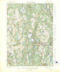
1935 Map of Shirley
USGS Topo · Published 1935About this map
Shirley and the industrial corridors of Leominster dominate this mid-1930s landscape, where the Boston and Maine RR tracks weave through a complex network of reservoirs and glacial terrain. The map captures a high density of named water bodies, including the central Shirley Reservoir and the expansive Whalom Pond, alongside smaller features like White Rabbit Swamp and Leatherboard Pond. Settlement patterns are clearly defined by the distinct clusters of Shirley Center, Goodrichville, and North Leominster.
Find a feature on this map
81 named features on this map. Tap any name to fly to it.
Don’t see what you’re looking for? This feature index may not catch every label — zoom into the map to look around manually.
Map Details
Editions of this 1935 Shirley Map
3 editions found
Other maps of this area

1885 · Worcester
USGS Topo · 1:62,500

1886 · Worcester
USGS Topo · 1:62,500

1887 · Marlboro
USGS Topo · 1:62,500

1887 · Fitchburg
USGS Topo · 1:62,500

1889 · Marlboro
USGS Topo · 1:62,500

1889 · Fitchburg
USGS Topo · 1:62,500

1892 · Worcester
USGS Topo · 1:62,500

1893 · Fitchburg
USGS Topo · 1:62,500

1893 · Groton
USGS Topo · 1:62,500

1896 · Marlboro
USGS Topo · 1:62,500