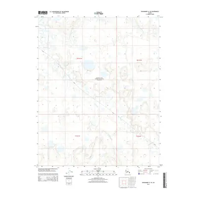
2014 Map of Shishmaref A-1 SE
USGS Topo · Published 2014About this map
The Bering Land Bridge National Preserve dominates this remote landscape on the Seward Peninsula, revealing an intricate network of Arctic hydrology. The Serpentine River and its northern branch, the N Fork Serpentine River, meander across the tundra, shaping a terrain defined by low-lying wetlands and thermal-influenced drainage. Smaller tributaries such as Grayling Cr and Lone Butte Cr contribute to the complex watershed, which remains largely untouched save for the Shi2009 route passing through the western and central portions of the quadrangle. This 2014 survey documents the hydrographic patterns of a region critical to understanding ancient migrations, where the absence of permanent settlements highlights the protected status of the preserve and the preservation of its natural contours.
Find a feature on this map
10 named features on this map. Tap any name to fly to it.
Don’t see what you’re looking for? This feature index may not catch every label — zoom into the map to look around manually.
Map Details
Editions of this 2014 Shishmaref A-1 SE Map
This is the sole edition of this map. No revisions or reprints were ever made.
Other maps of this area

1950 · Bendeleben D-6
USGS Topo · 1:63,360

1950 · Teller
USGS Topo · 1:250,000

1950 · Bendeleben
USGS Topo · 1:250,000

1950 · Shishmaref
USGS Topo · 1:250,000

1950 · Shishmaref A-1
USGS Topo · 1:63,360

1950 · Kotzebue A-6
USGS Topo · 1:63,360

1950 · Teller D-1
USGS Topo · 1:63,360

1951 · Shishmaref
USGS Topo · 1:250,000

1951 · Bendeleben
USGS Topo · 1:250,000

1951 · Kotzebue
USGS Topo · 1:250,000