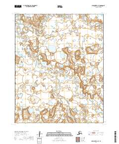
2019 Map of Shishmaref A-1 SE
USGS Topo · Published 2019About this map
The Bering Land Bridge National Preserve dominates this remote stretch of the Seward Peninsula, protecting a landscape defined by the winding hydrology of the Serpentine River and its tributaries. This 2019 survey captures a complex network of tundra wetlands and meandering waterways, including the North Fork Serpentine River and smaller streams such as Grayling Cr and Lone Butte Cr. The map's detail reflects the unique geological and ecological character of the preserve, which once served as part of the land bridge connecting Asia and North America. While devoid of permanent settlements or roads, the terrain is structured by township and range lines like t8n r31w and t7n r30w, providing a precise spatial record of this protected wilderness area within the Nome Census Area.
Find a feature on this map
9 named features on this map. Tap any name to fly to it.
Don’t see what you’re looking for? This feature index may not catch every label — zoom into the map to look around manually.
Map Details
Editions of this 2019 Shishmaref A-1 SE Map
This is the sole edition of this map. No revisions or reprints were ever made.
Other maps of this area

1950 · Bendeleben D-6
USGS Topo · 1:63,360

1950 · Teller
USGS Topo · 1:250,000

1950 · Bendeleben
USGS Topo · 1:250,000

1950 · Shishmaref
USGS Topo · 1:250,000

1950 · Shishmaref A-1
USGS Topo · 1:63,360

1950 · Kotzebue A-6
USGS Topo · 1:63,360

1950 · Teller D-1
USGS Topo · 1:63,360

1951 · Shishmaref
USGS Topo · 1:250,000

1951 · Bendeleben
USGS Topo · 1:250,000

1951 · Kotzebue
USGS Topo · 1:250,000