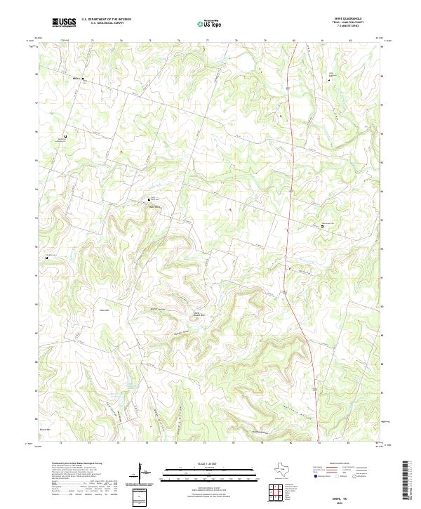
2022 Map of Shive
USGS Topo · Published 2022About this map
Shive and West Point serve as the primary focal points of this Hamilton County landscape, where the prairie begins to break into a complex system of ridges and hollows. The terrain is defined by prominent elevations such as Vista Mtn and Little Round Mtn, with drainage provided by the winding Cowhouse Cr and its tributaries. For genealogists and local historians, the high density of burial sites suggests a deeply rooted rural community structure, with Shive Cem, Saint Paul Lutheran Cem, and West Point Cem marking the historical centers of family life and worship.
Find a feature on this map
60 named features on this map. Tap any name to fly to it.
Don’t see what you’re looking for? This feature index may not catch every label — zoom into the map to look around manually.
Map Details
Editions of this 2022 Shive Map
This is the sole edition of this map. No revisions or reprints were ever made.
Other maps of this area

1887 · Lampasas
USGS Topo · 1:125,000

1888 · Hamilton
USGS Topo · 1:125,000

1894 · Hamilton
USGS Topo · 1:125,000

1894 · Lampasas
USGS Topo · 1:125,000

1954 · Brownwood
USGS Topo · 1:250,000

1954 · Evant
USGS Topo · 1:62,500

1954 · Evant
USGS Topo · 1:24,000
1954 · Pearl
USGS Topo · 1:24,000

1956 · Pottsville
USGS Topo · 1:62,500
1956 · Ohio
USGS Topo · 1:24,000