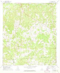
1971 Map of Shivers
USGS Topo · Published 1973About this map
The Old Indian Treaty Boundary cuts through this landscape, dividing Simpson, Lawrence, and Jefferson Davis Counties in the early 1970s. The settlement of Shivers serves as a local hub near the Illinois Central railroad line, which follows the drainage of Bush Creek and Silver Creek. The area is characterized by numerous country churches and family burial grounds, such as Pinola Cem Ch and Rose Hill Cem, indicating a long-established rural community structure.
Find a feature on this map
43 named features on this map. Tap any name to fly to it.
Don’t see what you’re looking for? This feature index may not catch every label — zoom into the map to look around manually.
Map Details
Editions of this 1971 Shivers Map
2 editions found
Other maps of this area

1953 · Hattiesburg
USGS Topo · 1:250,000

1953 · Natchez
USGS Topo · 1:250,000

1956 · Natchez
USGS Topo · 1:250,000

1958 · Hattiesburg
USGS Topo · 1:250,000

1959 · Natchez
USGS Topo · 1:250,000

1970 · Mendenhall East
USGS Topo · 1:24,000
1970 · Harrisville
USGS Topo · 1:24,000
1970 · Mendenhall West
USGS Topo · 1:24,000

1970 · New Hebron
USGS Topo · 1:24,000

1970 · Mount Carmel
USGS Topo · 1:24,000