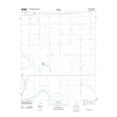
2012 Map of Shoals
USGS Topo · Published 2012About this map
The Red River marks the southern edge of this Oklahoma landscape, where the settlements of Fallon, Ord, and Shoals are connected by a strictly geometric grid of county roads. For genealogists and local historians, the area is defined by its small community burial grounds, including Shoat Springs Cem, Jones Cem, and Durant Cem, which are scattered throughout the agricultural plots north of the river. The terrain is drained by a series of southward-flowing waterways such as Carney Cr, Owl Cr, and Horse Cr. The proximity of Mt Olivet Cem near the northern boundary suggests a transition toward larger regional hubs, while the map's fine detail on rural routes like Spring Hill Rd and Grant Town Rd reveals the persistent network of local commerce and community life in this portion of Choctaw County.
Find a feature on this map
42 named features on this map. Tap any name to fly to it.
Don’t see what you’re looking for? This feature index may not catch every label — zoom into the map to look around manually.
Map Details
Editions of this 2012 Shoals Map
This is the sole edition of this map. No revisions or reprints were ever made.
Other maps of this area

1901 · Antlers
USGS Topo · 1:125,000

1901 · Alikchi
USGS Topo · 1:125,000

1903 · Paris
USGS Topo · 1:125,000

1912 · Antlers
USGS Topo · 1:125,000

1925 · Antlers
USGS Topo · 1:125,000

1948 · Grant
USGS Topo · 1:62,500

1949 · Grant
USGS Topo · 1:62,500

1950 · Mcalester
USGS Topo · 1:250,000

1951 · Slate Shoals
USGS Topo · 1:24,000

1951 · Frogville
USGS Topo · 1:24,000