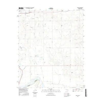
2016 Map of Shoals
USGS Topo · Published 2016About this map
The Red River forms the southern boundary of this region, separating Choctaw Co in Oklahoma from the Texas border. The landscape is defined by its rural cemetery network and small communities, with the northern edge dominated by the city of Hugo. Moving south toward the river, smaller settlements like Grant and Shoals are linked by a grid of agricultural roads, including Spring Hill Rd and E 2140 Rd. Numerous family and community burial grounds, such as Mount Olivet Cem, Durant Cem, and Shoat Springs Cem, are scattered across the terrain near winding waterways like Owl Cr and Carney Cr. This survey illustrates the transition from the concentrated development around the Jake Pulliam Byp to the wetlands and river bends of the state line, preserving the placement of local landmarks like Pleasant Hill Cem.
Find a feature on this map
51 named features on this map. Tap any name to fly to it.
Don’t see what you’re looking for? This feature index may not catch every label — zoom into the map to look around manually.
Map Details
Editions of this 2016 Shoals Map
This is the sole edition of this map. No revisions or reprints were ever made.
Other maps of this area

1901 · Antlers
USGS Topo · 1:125,000

1901 · Alikchi
USGS Topo · 1:125,000

1903 · Paris
USGS Topo · 1:125,000

1912 · Antlers
USGS Topo · 1:125,000

1925 · Antlers
USGS Topo · 1:125,000

1948 · Grant
USGS Topo · 1:62,500

1949 · Grant
USGS Topo · 1:62,500

1950 · Mcalester
USGS Topo · 1:250,000

1951 · Slate Shoals
USGS Topo · 1:24,000

1951 · Frogville
USGS Topo · 1:24,000