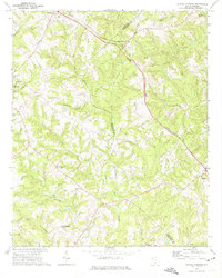
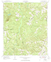
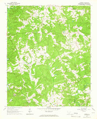
1971 Map of Shoals Junction
USGS Topo · Published 1975This historical map portrays the area of Shoals Junction in 1971, primarily covering Abbeville County as well as portions of Greenwood County. Featuring a scale of 1:24000, this map provides a highly detailed snapshot of the terrain, roads, buildings, counties, and historical landmarks in the Shoals Junction region at the time. Published in 1975, it is the sole known edition of this map.
Find a feature on this map
38 named features on this map. Tap any name to fly to it.
Don’t see what you’re looking for? This feature index may not catch every label — zoom into the map to look around manually.
Map Details
Editions of this 1971 Shoals Junction Map
This is the sole edition of this map. No revisions or reprints were ever made.
Historical Maps of Black Through Time
9 maps found

1948 Abbeville East
Abbeville County, SC

1948 Abbeville West
Abbeville County, SC
1948 Verdery
Abbeville County, SC
1949 Calhoun Creek
Abbeville County, SC

1950 Abbeville East
Abbeville County, SC
1950 Verdery
Abbeville County, SC
1964 Latimer
Abbeville County, SC
1971 Shoals Junction
Abbeville County, SC

1971 Ware Shoals West
Abbeville County, SC