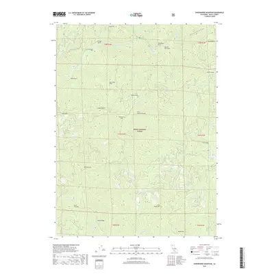
2018 Map of Shoeinhorse Mountain
USGS Topo · Published 2018About this map
The McCloud River carves through the heart of this section of the Shasta National Forest, a landscape defined by sharp elevation shifts and numerous drainage systems. Much of the northern terrain is accessible via the Pacific Crest National Scenic Trail, which winds through the hillsides past Ah-Di-Na Cg and several named gulches such as Fitzhugh Gulch and Doodlebug Gulch. The nomenclature of the peaks and ridges reflects a mix of local flora and whimsy, featuring landmarks like Ladybug Butte, Van Sicklin Butte, and the namesake Shoeinhorse Mtn. The southern portion of the map is dominated by the steep slopes of Bagley Mtn and Garden Ridge, while the hydrological network includes various tributaries of Squaw Cr and Claiborne Cr, showing a complex drainage pattern into the river valley.
Find a feature on this map
48 named features on this map. Tap any name to fly to it.
Don’t see what you’re looking for? This feature index may not catch every label — zoom into the map to look around manually.
Map Details
Editions of this 2018 Shoeinhorse Mountain Map
This is the sole edition of this map. No revisions or reprints were ever made.
Other maps of this area

1886 · Lassen Peak
USGS Topo · 1:250,000

1886 · Modoc Lava Bed
USGS Topo · 1:250,000

1886 · Shasta
USGS Topo · 1:250,000

1890 · Red Bluff
USGS Topo · 1:250,000

1892 · Modoc Lava-Bed
USGS Topo · 1:250,000

1892 · Lassen Peak
USGS Topo · 1:250,000

1894 · Lassen Peak
USGS Topo · 1:250,000

1894 · Red Bluff
USGS Topo · 1:250,000

1894 · Shasta
USGS Topo · 1:250,000

1901 · Redding
USGS Topo · 1:125,000