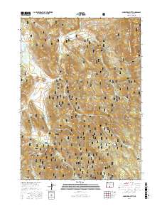
2017 Map of Shoestring Butte
USGS Topo · Published 2017About this map
The Fremont National Forest defines this high-elevation landscape in Lake County, where the Chewaucan River and numerous tributaries like Dairy Cr and Farrow Cr carve through the volcanic terrain. This 2017 survey reveals a network of forest development roads, including Natl Forest Develop Road 3510 Rd, which provide access to a series of prominent peaks and buttes. For those researching the hydrological geography of the region, the map identifies several named water sources such as Lucky Six Spring, Paddy Spring, and Shoestring Spring. The eastern edge of the quadrangle is marked by the Southern Oregon Intertie Trail, which passes near Moss Pass Butte and Round Mtn, reflecting the area's continued importance for recreational and resource management.
Find a feature on this map
35 named features on this map. Tap any name to fly to it.
Don’t see what you’re looking for? This feature index may not catch every label — zoom into the map to look around manually.
Map Details
Editions of this 2017 Shoestring Butte Map
This is the sole edition of this map. No revisions or reprints were ever made.
Other maps of this area

1955 · Klamath Falls
USGS Topo · 1:250,000

1958 · Klamath Falls
USGS Topo · 1:250,000

1964 · Cox Flat
USGS Topo · 1:24,000

1964 · Coleman Point
USGS Topo · 1:24,000

1964 · Cougar Peak
USGS Topo · 1:24,000

1964 · Shoestring Butte
USGS Topo · 1:24,000

1964 · Clover Flat
USGS Topo · 1:24,000

1964 · Big Baldy
USGS Topo · 1:24,000

1966 · Morgan Butte
USGS Topo · 1:24,000

1966 · Tucker Hill
USGS Topo · 1:24,000