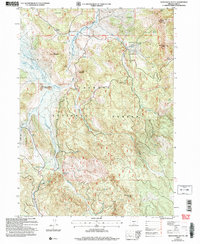
2004 Map of Shoestring Butte
USGS Topo · Published 2007About this map
The Fremont National Forest dominates this section of Lake County, where high-elevation drainage patterns define the landscape of the early 2000s. The Chewaucan River carves through the northern reaches, fed by a network of tributaries including Ben Young Creek and Elder Creek. For researchers of forest management and infrastructure, the presence of the Thomas Creek Work Center and the Shoestring Butte Lookout indicate the ongoing human monitoring of these timberlands.
Find a feature on this map
21 named features on this map. Tap any name to fly to it.
Don’t see what you’re looking for? This feature index may not catch every label — zoom into the map to look around manually.
Map Details
Editions of this 2004 Shoestring Butte Map
This is the sole edition of this map. No revisions or reprints were ever made.
Other maps of this area

1955 · Klamath Falls
USGS Topo · 1:250,000

1958 · Klamath Falls
USGS Topo · 1:250,000

1964 · Cox Flat
USGS Topo · 1:24,000

1964 · Coleman Point
USGS Topo · 1:24,000

1964 · Cougar Peak
USGS Topo · 1:24,000

1964 · Shoestring Butte
USGS Topo · 1:24,000

1964 · Clover Flat
USGS Topo · 1:24,000

1964 · Big Baldy
USGS Topo · 1:24,000

1966 · Morgan Butte
USGS Topo · 1:24,000

1966 · Tucker Hill
USGS Topo · 1:24,000