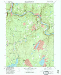
1994 Map of Shohola
USGS Topo · Published 1995About this map
The Delaware River carves a sharp, serpentine path through the borderlands of Pennsylvania and New York, anchoring the communities of Shohola and Barryville. This landscape is defined by its recreation and conservation history, featuring the Upper Delaware National Scenic and Recreational River and extensive protected areas like State Game Lands No 116. Cultural landmarks are prominent along the river corridor, including the Zane Grey Museum near Lackawaxen and the Roebling Bridge, which connects the two states. Inland, the terrain rises toward German Hill and Bald Hill, where local history is preserved at the German Hill Cem and Woodtown Cem. Large water bodies such as Walker Lake and Twin Lakes suggest a transition toward seasonal residential and recreational development by the mid-1990s, while the Minisink Battleground Park Monument marks an earlier era of conflict on the heights overlooking the valley.
Find a feature on this map
53 named features on this map. Tap any name to fly to it.
Don’t see what you’re looking for? This feature index may not catch every label — zoom into the map to look around manually.
Map Details
Editions of this 1994 Shohola Map
This is the sole edition of this map. No revisions or reprints were ever made.
Other maps of this area

1913 · Milford
USGS Topo · 1:62,500

1915 · Milford
USGS Topo · 1:62,500

1920 · Damascus
USGS Topo · 1:62,500

1922 · White Lake
USGS Topo · 1:62,500

1923 · Damascus
USGS Topo · 1:62,500

1935 · Hawley
USGS Topo · 1:62,500

1938 · Hawley
USGS Topo · 1:62,500

1942 · White Lake
USGS Topo · 1:62,500

1943 · Honesdale
USGS Topo · 1:125,000

1943 · White Lake
USGS Topo · 1:62,500