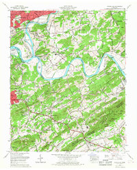
1966 Map of Shooks Gap
USGS Topo · Published 1968About this map
Fort Loudoun Lake and the winding French Broad River dominate this mid-1960s landscape, illustrating the complex hydrology southeast of Knoxville. The map captures the transition from industrial extractive sites like Meades Quarry and Neubert Quarry to the established neighborhoods of Marbledale and Kimberlin Heights. The Southern Railway corridor serves as a primary artery through these communities, connecting the agricultural river bottomlands with the growing suburbs.
Find a feature on this map
107 named features on this map. Tap any name to fly to it.
Don’t see what you’re looking for? This feature index may not catch every label — zoom into the map to look around manually.
Map Details
Editions of this 1966 Shooks Gap Map
This is the sole edition of this map. No revisions or reprints were ever made.
Other maps of this area

1886 · Knoxville
USGS Topo · 1:125,000

1892 · Knoxville
USGS Topo · 1:125,000

1894 · Knoxville
USGS Topo · 1:125,000

1895 · Knoxville
USGS Topo · 1:125,000

1897 · Maynardville
USGS Topo · 1:125,000

1900 · Maynardville
USGS Topo · 1:125,000

1901 · Knoxville
USGS Topo · 1:125,000

1935 · Mascot
USGS Topo · 1:24,000

1935 · Knoxville
USGS Topo · 1:48,000

1935 · Straw Plains
USGS Topo · 1:48,000