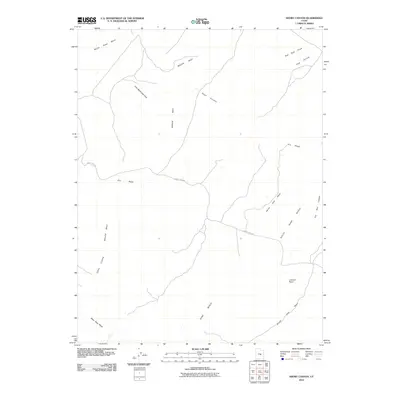
2010 Map of Short Canyon
USGS Topo · Published 2010About this map
Molen Reef dominates this arid landscape in Emery County, cutting a distinctive geological path across the terrain. This 2010 survey by the U.S. Geological Survey documents a region defined by dramatic vertical relief and seasonal watercourses, including the Molen Seep Wash and the winding Bitter Seep Wash to the south. The presence of the Coal Cliffs underscores the area's rich geological history, while features like the John McDonald Hole suggest early ranching or local naming traditions that predate modern mapping.
Find a feature on this map
15 named features on this map. Tap any name to fly to it.
Don’t see what you’re looking for? This feature index may not catch every label — zoom into the map to look around manually.
Map Details
Editions of this 2010 Short Canyon Map
This is the sole edition of this map. No revisions or reprints were ever made.
Other maps of this area

1885 · San Rafael
USGS Topo · 1:250,000

1885 · Manti
USGS Topo · 1:250,000

1885 · Fish Lake
USGS Topo · 1:250,000

1886 · Price River
USGS Topo · 1:250,000

1895 · Manti
USGS Topo · 1:250,000

1896 · Price River
USGS Topo · 1:250,000

1896 · Fish Lake
USGS Topo · 1:250,000

1923 · Castle Dale
USGS Topo · 1:62,500

1925 · Castle Dale
USGS Topo · 1:62,500

1952 · San Rafael Knob
USGS Topo · 1:62,500