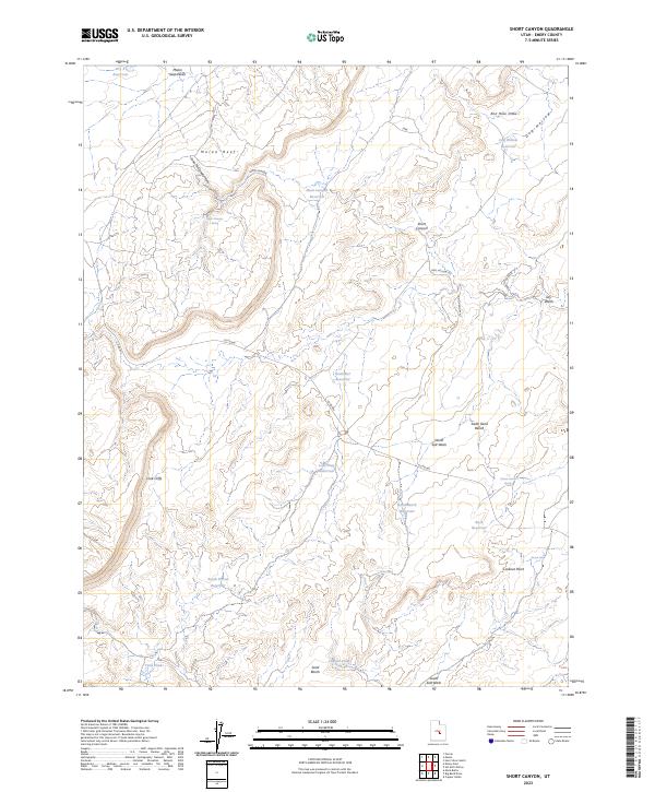
2023 Map of Short Canyon
USGS Topo · Published 2023About this map
Molen Reef and the Coal Cliffs dominate this portion of the Emery County landscape, where the high desert terrain is punctuated by an extensive system of water management features. The distribution of sites like Rochester Reservoir, Lone Tree Reservoir, and Sand Bench Reservoir reflects the critical importance of water storage in this arid region. Locally named landmarks such as John McDonald Hole and Hiram Corry Spring provide genealogical points of interest, suggesting early ranching or homesteading history in the area. Transportation in this territory relies on established routes like Co RD 803 and Dog Hollow Rd, which navigate the complex topography defined by Short Canyon and Dog Hollow. From the heights of Lookout Point down to the South Salt Wash, the map documents a geography where every spring and seep, such as Jensen Seep, is a vital resource.
Find a feature on this map
30 named features on this map. Tap any name to fly to it.
Don’t see what you’re looking for? This feature index may not catch every label — zoom into the map to look around manually.
Map Details
Editions of this 2023 Short Canyon Map
This is the sole edition of this map. No revisions or reprints were ever made.
Other maps of this area

1885 · San Rafael
USGS Topo · 1:250,000

1885 · Manti
USGS Topo · 1:250,000

1885 · Fish Lake
USGS Topo · 1:250,000

1886 · Price River
USGS Topo · 1:250,000

1895 · Manti
USGS Topo · 1:250,000

1896 · Price River
USGS Topo · 1:250,000

1896 · Fish Lake
USGS Topo · 1:250,000

1923 · Castle Dale
USGS Topo · 1:62,500

1925 · Castle Dale
USGS Topo · 1:62,500

1952 · San Rafael Knob
USGS Topo · 1:62,500