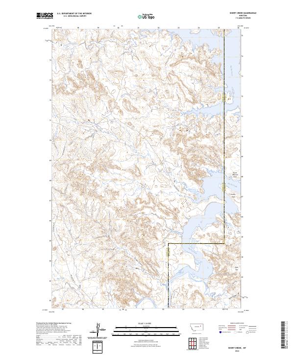
2024 Map of Short Creek
USGS Topo · Published 2024About this map
The Charles M Russell National Wildlife Refuge dominates this Montana landscape, where the waters of Big Dry Creek carve through the breaks of the Missouri River country. The terrain is defined by a complex network of drainages and coulees, including Bridge Coulee, Egan Coulee, and Short Creek. These watercourses feed into the expansive reservoir environment of the northern plains, characterized by prominent landforms like North Twitchell Point and Stubby Point that overlook the inundation. Along the southern reaches, Egan Flat provides a rare level stretch of ground amidst the dissected breaks. The presence of Van Norman Rd and Stubby Rd indicates the limited transit routes through this protected wilderness area. This geography reflects a modern era of conservation and land management, preserving a significant portion of the river valley for wildlife and public use.
Find a feature on this map
22 named features on this map. Tap any name to fly to it.
Don’t see what you’re looking for? This feature index may not catch every label — zoom into the map to look around manually.
Map Details
Editions of this 2024 Short Creek Map
This is the sole edition of this map. No revisions or reprints were ever made.
Other maps of this area

1954 · Jordan
USGS Topo · 1:250,000

1956 · Jordan
USGS Topo · 1:250,000

1958 · Jordan
USGS Topo · 1:250,000

1964 · Jordan
USGS Topo · 1:250,000

1967 · Hagen Gap
USGS Topo · 1:24,000

1967 · Frank Coulee
USGS Topo · 1:24,000

1972 · Short Creek
USGS Topo · 1:24,000

1972 · Flat Creek School
USGS Topo · 1:24,000

1972 · Ash Creek East
USGS Topo · 1:24,000
1972 · Ash Creek West
USGS Topo · 1:24,000