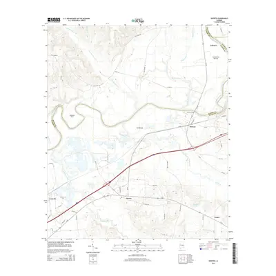
2014 Map of Shorter
USGS Topo · Published 2014About this map
Tallapoosa River meanders through the northeast corner of this map, defining the boundary between Elmore, Macon, and Tallapoosa counties. The landscape is characterized by the wide alluvial Tuckabatchie Bottoms and the prominent Robinson Bend. South of the river, the corridor along Us-80 and the interstate reveals the contemporary growth of Shorter, while surrounding settlements like Milstead, Tysonville, and Calebee maintain a more rural character.
Find a feature on this map
59 named features on this map. Tap any name to fly to it.
Don’t see what you’re looking for? This feature index may not catch every label — zoom into the map to look around manually.
Map Details
Editions of this 2014 Shorter Map
This is the sole edition of this map. No revisions or reprints were ever made.
Other maps of this area

1901 · Wetumpka
USGS Topo · 1:125,000

1901 · Wetumpka
USGS Topo · 1:62,500

1903 · Wetumpka
USGS Topo · 1:125,000

1906 · Dadeville
USGS Topo · 1:125,000

1953 · Montgomery
USGS Topo · 1:250,000

1955 · Phenix City
USGS Topo · 1:250,000

1956 · Montgomery
USGS Topo · 1:250,000

1957 · Phenix City
USGS Topo · 1:250,000

1957 · Montgomery
USGS Topo · 1:250,000

1958 · Phenix City
USGS Topo · 1:250,000