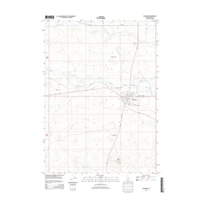
2013 Map of Shoshone
USGS Topo · Published 2013About this map
Shoshone serves as the focal point of this South Central Idaho survey, where the Big Wood River and Little Wood River converge amidst a landscape heavily shaped by agricultural engineering. The intricate path of the Milner Gooding Canal illustrates the region's reliance on irrigation, winding through the northern sections of the map to support the high desert plains. Evidence of the local civic life is found at the Lincoln County Fairgrounds on the eastern edge of town, while the surrounding terrain is marked by distinct volcanic or erosional features like Notch Butte, Big Drops, and Little Drops. Small community markers such as Disney northwest of the main settlement reflect the sparse but persistent human footprint in this volcanic river valley. The dense street grid of the town center contrasts with the wide-reaching ranch roads like Olinger Rd and Arkoosh Rd that extend into the surrounding townships.
Find a feature on this map
46 named features on this map. Tap any name to fly to it.
Don’t see what you’re looking for? This feature index may not catch every label — zoom into the map to look around manually.
Map Details
Editions of this 2013 Shoshone Map
This is the sole edition of this map. No revisions or reprints were ever made.
Other maps of this area

1955 · Twin Falls
USGS Topo · 1:250,000

1955 · Hailey
USGS Topo · 1:250,000

1957 · Thorn Creek SE
USGS Topo · 1:24,000

1957 · Thorn Creek
USGS Topo · 1:62,500

1958 · Twin Falls
USGS Topo · 1:250,000

1959 · Hailey
USGS Topo · 1:250,000

1962 · Hailey
USGS Topo · 1:250,000

1971 · Shoshone SE
USGS Topo · 1:24,000

1971 · Dietrich
USGS Topo · 1:24,000

1971 · Tunupa
USGS Topo · 1:24,000