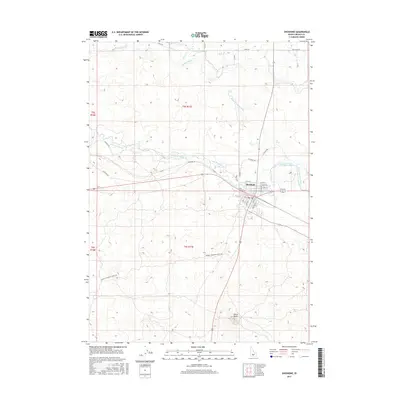
2017 Map of Shoshone
USGS Topo · Published 2017About this map
Shoshone sits at the confluence of desert hydrology and agricultural engineering in this southern Idaho landscape. The town serves as a focal point where the Little Wood River and Big Wood River converge, their waters managed by a complex network of irrigation infrastructure including the Milner Gooding Canal and Lateral C. This reliance on water management is further evidenced by the Sherock Hydro facility and several river features such as Little Drops and Big Drops. To the south, the terrain is defined by the prominent volcanic profile of Notch Butte. The map also traces the historic path of the Wendell-Shoshone Sheep Trl, a route reflecting the region's enduring ranching heritage. Local street grids in Shoshone, including N Rail St W and W A St, reveal the town's structural alignment with the railroad and the river corridor.
Find a feature on this map
29 named features on this map. Tap any name to fly to it.
Don’t see what you’re looking for? This feature index may not catch every label — zoom into the map to look around manually.
Map Details
Editions of this 2017 Shoshone Map
This is the sole edition of this map. No revisions or reprints were ever made.
Other maps of this area

1955 · Twin Falls
USGS Topo · 1:250,000

1955 · Hailey
USGS Topo · 1:250,000

1957 · Thorn Creek SE
USGS Topo · 1:24,000

1957 · Thorn Creek
USGS Topo · 1:62,500

1958 · Twin Falls
USGS Topo · 1:250,000

1959 · Hailey
USGS Topo · 1:250,000

1962 · Hailey
USGS Topo · 1:250,000

1971 · Shoshone SE
USGS Topo · 1:24,000

1971 · Dietrich
USGS Topo · 1:24,000

1971 · Tunupa
USGS Topo · 1:24,000