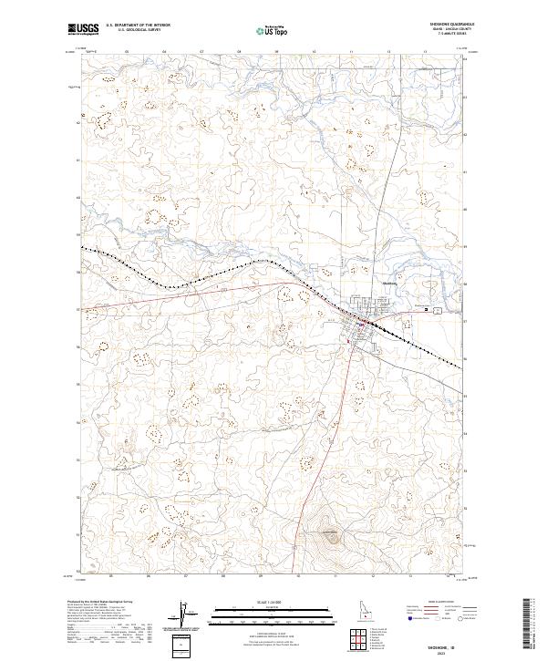
2023 Map of Shoshone
USGS Topo · Published 2023About this map
Shoshone serves as the focal point of this 2023 survey, situated at the confluence of the Big Wood River and Little Wood River. The town's civic identity is anchored by the Lincoln County Courthouse, while the surrounding landscape reveals a sophisticated irrigation and energy network including the Milner Gooding Canal and the Shorock Hydro facility. South of the town center, the terrain is marked by volcanic features like Notch Butte, and a network of named tracks such as the Wendell-Shoshone Sheep Trl point to the region's agricultural and livestock heritage. The map documents the intricate street grid of the town, from the rail-adjacent S Rail St W to the residential edges near Shoshone Cem. These geographic markers illustrate how modern Lincoln County manages its water resources and transportation corridors across the high desert plains.
Find a feature on this map
43 named features on this map. Tap any name to fly to it.
Don’t see what you’re looking for? This feature index may not catch every label — zoom into the map to look around manually.
Map Details
Editions of this 2023 Shoshone Map
This is the sole edition of this map. No revisions or reprints were ever made.
Other maps of this area

1955 · Twin Falls
USGS Topo · 1:250,000

1955 · Hailey
USGS Topo · 1:250,000

1957 · Thorn Creek SE
USGS Topo · 1:24,000

1957 · Thorn Creek
USGS Topo · 1:62,500

1958 · Twin Falls
USGS Topo · 1:250,000

1959 · Hailey
USGS Topo · 1:250,000

1962 · Hailey
USGS Topo · 1:250,000

1971 · Shoshone SE
USGS Topo · 1:24,000

1971 · Dietrich
USGS Topo · 1:24,000

1971 · Tunupa
USGS Topo · 1:24,000