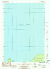
1985 Map of Shot Point
USGS Topo · Published 1985About this map
Lake Superior dominates this mid-1980s coastal chart, defining the northern boundary of the Upper Peninsula where Chocolay Twp Marquette Co meets Alger Co. The map focuses heavily on the shoreline and the expansive waters of the Great Lakes, featuring the prominent landform known as Shot Point on the western edge. This provisional data highlights the coastal geography of the Onota area, showing the interface between the lake and the forested inland townships. The transition between Marquette and Alger counties is clearly delineated along this stretch of the Superior coast, providing a clear record of the jurisdictional boundaries and natural topography as they stood during the field checks of 1982.
Find a feature on this map
6 named features on this map. Tap any name to fly to it.
Don’t see what you’re looking for? This feature index may not catch every label — zoom into the map to look around manually.
Map Details
Editions of this 1985 Shot Point Map
This is the sole edition of this map. No revisions or reprints were ever made.
Other maps of this area

1932 · Skandia NE
USGS Topo · 1:31,680

1950 · Skandia NW
USGS Topo · 1:31,680

1958 · Laughing Fish Point
USGS Topo · 1:62,500

1958 · Skandia
USGS Topo · 1:62,500

1958 · Marquette
USGS Topo · 1:250,000

1960 · Marquette
USGS Topo · 1:250,000

1961 · Marquette
USGS Topo · 1:250,000

1968 · Marquette
USGS Topo · 1:250,000
1983 · Gwinn
USGS Topo · 1:100,000
1985 · Sand River
USGS Topo · 1:24,000