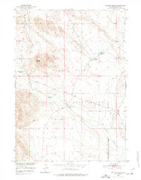
1950 Map of Shotgun Butte
USGS Topo · Published 1977About this map
Wind River Indian Reservation lands dominate this mid-century landscape, illustrating the intersection of ranching life and federal water management in central Wyoming. The map records a series of named ranching outposts, including Cannonball Ranch, Merriam Ranch, and Arapahoe Ranch, which reflect the early 20th-century settlement patterns of the region. A notable genealogical marker is found at Shotgun Ranch (Aban'd), recorded as abandoned by the time of the 1948 aerial photography used for this survey.
Find a feature on this map
18 named features on this map. Tap any name to fly to it.
Don’t see what you’re looking for? This feature index may not catch every label — zoom into the map to look around manually.
Map Details
Editions of this 1950 Shotgun Butte Map
2 editions found
Other maps of this area

1950 · Pavillion Butte
USGS Topo · 1:24,000

1950 · Harris Bridge
USGS Topo · 1:24,000

1950 · Shotgun Butte
USGS Topo · 1:24,000

1951 · Eagle Point
USGS Topo · 1:24,000

1951 · Lookout Butte
USGS Topo · 1:24,000

1951 · Jenkins Mountain
USGS Topo · 1:24,000

1952 · Kates Basin
USGS Topo · 1:24,000

1952 · Sheep Ridge
USGS Topo · 1:24,000

1952 · Bargee
USGS Topo · 1:24,000

1955 · Thermopolis
USGS Topo · 1:250,000