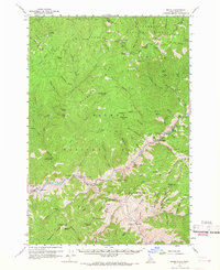
1960 Map of Shoup
USGS Topo · Published 1967About this map
The Salmon River carves a deep path through the Salmon River Mountains in this 1960 field-checked survey of the Idaho-Montana borderlands. The settlement of Shoup serves as the primary hub along the river, surrounded by a landscape defined by 19th and early 20th-century extraction. Numerous mining operations are documented throughout the drainage basins, including the Gregor Mine, Nabob Mine, and Clipper Bullion Mine.
Find a feature on this map
93 named features on this map. Tap any name to fly to it.
Don’t see what you’re looking for? This feature index may not catch every label — zoom into the map to look around manually.
Map Details
Editions of this 1960 Shoup Map
2 editions found
Other maps of this area

1950 · Blackbird Mtn
USGS Topo · 1:62,500

1950 · Leesburg
USGS Topo · 1:62,500

1951 · Leesburg
USGS Topo · 1:62,500

1951 · Blackbird Mtn
USGS Topo · 1:62,500

1956 · Elk City
USGS Topo · 1:250,000

1960 · Elk City
USGS Topo · 1:250,000

1960 · Painted Rocks Lake
USGS Topo · 1:62,500

1960 · Ulysses Mtn
USGS Topo · 1:62,500

1960 · Shoup
USGS Topo · 1:62,500

1960 · Piquett Mountain
USGS Topo · 1:62,500