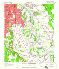
1959 Map of Shreveport East
USGS Topo · Published 1960About this map
Shreveport and Bossier City are divided by the winding course of the Red River in this 1959 survey, which captures the post-war expansion of residential neighborhoods and institutional infrastructure. The map details a dense network of educational and religious sites, from the campus of Centenary College to local landmarks like Byrd High Sch and Broadmoor Jr High Sch. To the east, the vast installation of Barksdale Air Force Base dominates the landscape, while the southern reaches of the quadrangle transition into the fertile alluvial plains of the river valley. Here, the Red River Valley Agricultural Station and family-named landmarks like Mary Goula Ch and Ellerbe Ch suggest a more rural, agrarian character. The intricate hydrology of the area is well-defined, featuring numerous oxbows and islands such as Sunny Point Lake and Shreve Island, alongside the industrial presence of the Kansas City Southern and Texas and Pacific railroads.
Find a feature on this map
62 named features on this map. Tap any name to fly to it.
Don’t see what you’re looking for? This feature index may not catch every label — zoom into the map to look around manually.
Map Details
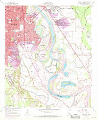
Editions of this 1959 Shreveport East Map
2 editions found
Other maps of this area

1932 · Bossier SE
USGS Topo · 1:31,680

1932 · Bossier SW
USGS Topo · 1:31,680

1932 · Shreveport SE
USGS Topo · 1:31,680

1938 · Arnsberg
USGS Topo · 1:31,680

1941 · Forbing
USGS Topo · 1:31,680

1945 · Greenwood
USGS Topo · 1:62,500

1948 · Mooringsport
USGS Topo · 1:62,500

1948 · Bossier City
USGS Topo · 1:62,500

1948 · Caspiana
USGS Topo · 1:62,500

1955 · Shreveport
USGS Topo · 1:250,000