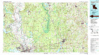
1986 Map of Shreveport North
USGS Topo · Published 1988About this map
Shreveport and Bossier City anchor this mid-1980s landscape, where the Red River meanders through a complex network of bayous and reservoirs. The regional economy is defined by heavy industry and military infrastructure, most notably the sprawling Barksdale Air Force Base in the south and the Louisiana Army Ammunition Plant to the east. Transportation corridors such as the Kansas City Southern RR and St Louis Southwestern RR connect legacy oil-field towns like Oil City and Mooringsport near the waters of Caddo Lake. Significant conservation and recreational tracts are visible, including the Bodcau State Wildlife Management Area following its namesake bayou and portions of the Kisatchie National Forest. From the northern border at Rodessa down to Cross Lake, the map documents the dense transition from rural parishes to a developing urban riverfront.
Find a feature on this map
118 named features on this map. Tap any name to fly to it.
Don’t see what you’re looking for? This feature index may not catch every label — zoom into the map to look around manually.
Map Details
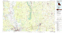
Editions of this 1986 Shreveport North Map
2 editions found
Other maps of this area

1907 · Atlanta
USGS Topo · 1:62,500

1910 · Atlanta
USGS Topo · 1:62,500

1922 · Sarepta
USGS Topo · 1:62,500

1924 · Sarepta
USGS Topo · 1:62,500

1932 · Hosston NW
USGS Topo · 1:31,680

1932 · Bossier SE
USGS Topo · 1:31,680

1932 · Hosston NE
USGS Topo · 1:31,680

1932 · Bossier NE
USGS Topo · 1:31,680

1932 · Bossier SW
USGS Topo · 1:31,680

1932 · Shreveport SE
USGS Topo · 1:31,680