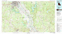
1985 Map of Shreveport South
USGS Topo · Published 1988About this map
The Red River corridor defines this mid-1980s landscape, winding through a complex of bayous and alluvial plains south of the Shreveport and Bossier City metropolitan area. The strategic importance of the region is anchored by Barksdale Air Force Base, while the industrial character of the era is evident in the sprawling Sligo Oil and Gas Field and Bistineau Gas Field. Transportation networks are well-developed, showing the Kansas City Southern RR and Illinois Central Gulf RR navigating the lowlands alongside Interstate 20. Further south, the map captures the transition into more wooded terrain within the Kisatchie National Forest and the conserved wetlands of the Loggy Bayou State Wildlife Management Area. Smaller settlements like Coushatta, Ringgold, and Taylortown provide a view into the rural centers of the Red River valley during this period of the late twentieth century.
Find a feature on this map
97 named features on this map. Tap any name to fly to it.
Don’t see what you’re looking for? This feature index may not catch every label — zoom into the map to look around manually.
Map Details
Editions of this 1985 Shreveport South Map
2 editions found
Other maps of this area

1932 · Bossier SE
USGS Topo · 1:31,680

1932 · Bossier SW
USGS Topo · 1:31,680

1932 · Shreveport SE
USGS Topo · 1:31,680

1937 · Campti NE
USGS Topo · 1:31,680

1937 · Campti NW
USGS Topo · 1:31,680

1938 · Chemard Lake
USGS Topo · 1:31,680

1938 · Lake End
USGS Topo · 1:31,680

1938 · Arnsberg
USGS Topo · 1:31,680

1941 · East Point
USGS Topo · 1:31,680

1941 · Forbing
USGS Topo · 1:31,680