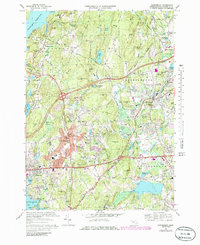
1969 Map of Shrewsbury
USGS Topo · Published 1986About this map
Wachusett Reservoir and its southeastern shores anchor this survey of the Worcester area, where the rugged terrain is defined by dozens of named hills like Longley Hill, Barnard Hill, and Sulphur Hill. The residential growth of Shrewsbury and Northborough is evident, particularly in the sprawling residential subdivisions of South Shrewsbury and Fairlawn near the edge of Lake Quinsigamond. This 1960s-era landscape reveals a community transitioning toward modern suburbanization, yet it remains closely tied to its geographic features such as Rocky Pond, Stiles Reservoir, and the Assabet River.
Find a feature on this map
134 named features on this map. Tap any name to fly to it.
Don’t see what you’re looking for? This feature index may not catch every label — zoom into the map to look around manually.
Map Details
Editions of this 1969 Shrewsbury Map
4 editions found
Other maps of this area

1885 · Worcester
USGS Topo · 1:62,500

1886 · Worcester
USGS Topo · 1:62,500

1886 · Blackstone
USGS Topo · 1:62,500

1887 · Marlboro
USGS Topo · 1:62,500

1889 · Marlboro
USGS Topo · 1:62,500

1889 · Blackstone
USGS Topo · 1:62,500

1889 · Webster
USGS Topo · 1:62,500

1892 · Webster
USGS Topo · 1:62,500

1892 · Worcester
USGS Topo · 1:62,500

1893 · Blackstone
USGS Topo · 1:62,500