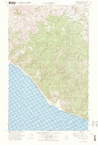
1969 Map of Shubrick Peak
USGS Topo · Published 1975About this map
Shubrick Peak and Hadley Peak rise sharply above the Pacific coastline within the King Range National Conservation Area, where the coastline is defined by dramatic changes in elevation. The 1969 landscape is sparsely populated, dominated by high ridges like Moody Ridge and Harris Ridge that overlook the winding course of the Mattole River. Along the shore, a series of coastal benches known as Big Flat and Miller Flat provide the only level ground between the crashing surf and the steep mountain front.
Find a feature on this map
47 named features on this map. Tap any name to fly to it.
Don’t see what you’re looking for? This feature index may not catch every label — zoom into the map to look around manually.
Map Details
Editions of this 1969 Shubrick Peak Map
2 editions found
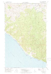
Other maps of this area

1919 · Glynn
USGS Topo · 1:62,500

1920 · Pt. Delagda
USGS Topo · 1:62,500

1921 · Cape Mendocino
USGS Topo · 1:62,500

1926 · Gorda
USGS Topo · 1:62,500

1949 · Eureka
USGS Topo · 1:250,000

1949 · Point Delgada
USGS Topo · 1:62,500

1950 · Cape Mendocino
USGS Topo · 1:62,500

1950 · Scotia
USGS Topo · 1:62,500

1951 · Scotia
USGS Topo · 1:62,500

1951 · Point Delgada
USGS Topo · 1:62,500