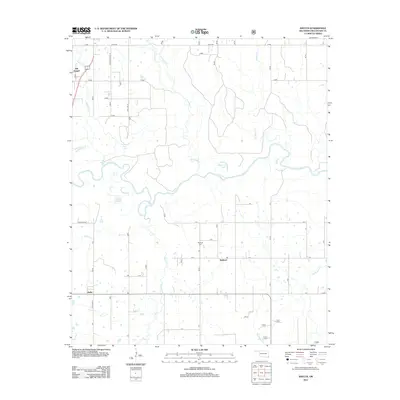
2012 Map of Shults
USGS Topo · Published 2012About this map
The Little River meanders across this McCurtain County landscape, defining the local geography between the small settlements of Redland and Shults. To the north, the terrain is partitioned by several major tributaries including Yashau Cr, Yanubbee Cr, and Terrapin Cr, creating a complex network of waterways and low-lying basins. Local history is anchored by the Hill Chapel community in the northwest and the Redland Cemetery further south, landmarks that serve as vital points of reference for genealogists and researchers of the area's rural development. The presence of Pine Lake and Deeberry Lake suggests a reliance on the river system for recreation and water management. This 2012 survey by the U.S. Geological Survey details the modern road network, including State Hwy 3 and Craig Rd, which connect these dispersed rural communities and family-named landmarks.
Find a feature on this map
20 named features on this map. Tap any name to fly to it.
Don’t see what you’re looking for? This feature index may not catch every label — zoom into the map to look around manually.
Map Details
Editions of this 2012 Shults Map
This is the sole edition of this map. No revisions or reprints were ever made.
Other maps of this area

1902 · Lukfata
USGS Topo · 1:125,000

1950 · Mcalester
USGS Topo · 1:250,000

1950 · Idabel
USGS Topo · 1:24,000

1950 · Shults
USGS Topo · 1:24,000

1950 · Haworth
USGS Topo · 1:24,000

1950 · Goodwater
USGS Topo · 1:24,000

1950 · Bokhoma
USGS Topo · 1:24,000

1951 · Idabel
USGS Topo · 1:24,000

1951 · Idabel SE
USGS Topo · 1:24,000

1951 · Haworth
USGS Topo · 1:24,000