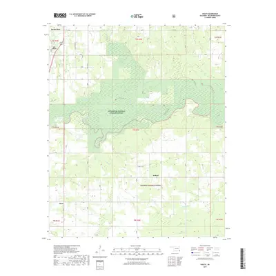
2019 Map of Shults
USGS Topo · Published 2019About this map
Little River National Wildlife Refuge dominates the central portion of this McCurtain County landscape, where the meandering Little River carves a path through dense bottomland. The geography is defined by a transition from the southern edge of the Ouachita National Forest into the river valley. To the west, the community of Broken Bow is visible near the intersection of several local routes, while the rural settlement of Hill Chapel stands nearby.
Find a feature on this map
33 named features on this map. Tap any name to fly to it.
Don’t see what you’re looking for? This feature index may not catch every label — zoom into the map to look around manually.
Map Details
Editions of this 2019 Shults Map
This is the sole edition of this map. No revisions or reprints were ever made.
Other maps of this area

1902 · Lukfata
USGS Topo · 1:125,000

1950 · Mcalester
USGS Topo · 1:250,000

1950 · Idabel
USGS Topo · 1:24,000

1950 · Shults
USGS Topo · 1:24,000

1950 · Haworth
USGS Topo · 1:24,000

1950 · Goodwater
USGS Topo · 1:24,000

1950 · Bokhoma
USGS Topo · 1:24,000

1951 · Idabel
USGS Topo · 1:24,000

1951 · Idabel SE
USGS Topo · 1:24,000

1951 · Haworth
USGS Topo · 1:24,000