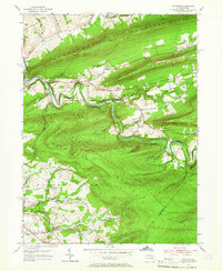
1955 Map of Shumans
USGS Topo · Published 1966About this map
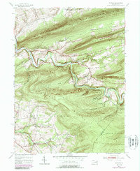
Catawissa Creek carves a winding path through the heart of this mid-century landscape, separating the massive slopes of Nescopeck Mountain and Cauley Mountain from the southern heights of Catawissa Mountain. The settlement pattern follows the narrow valley floors and ridge gaps, centering on small communities like Shumans and Mainville. This 1950s update of 1940s aerial surveys reveals a rural infrastructure built around local landmarks, including Harkers Ch, Beaver Sch, and Michaels Cem.
Find a feature on this map
36 named features on this map. Tap any name to fly to it.
Don’t see what you’re looking for? This feature index may not catch every label — zoom into the map to look around manually.
Map Details
Editions of this 1955 Shumans Map
5 editions found
Other maps of this area

1889 · Catawissa
USGS Topo · 1:62,500

1892 · Catawissa
USGS Topo · 1:62,500

1892 · Mahanoy
USGS Topo · 1:62,500

1893 · Mahanoy
USGS Topo · 1:62,500

1894 · Catawissa
USGS Topo · 1:62,500

1894 · Shickshinny
USGS Topo · 1:62,500

1894 · Bloomsburg
USGS Topo · 1:62,500

1946 · Berwick
USGS Topo · 1:31,680

1947 · Bloomsburg
USGS Topo · 1:24,000

1947 · Ashland
USGS Topo · 1:24,000
Featured Places
- North Union Township, PA
- Beaver Township, PA
- Locust Township, PA
- Main Township, PA
- Roaring Creek Township, PA