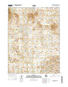
2015 Map of Shungnak D-5 NE
USGS Topo · Published 2015About this map
Kobuk Valley National Park occupies the northwest corner of this sub-arctic landscape, where a complex network of waterways defines the terrain. The drainage systems of the Kugarak River and Kugaruk River dominate the southern half of the quadrangle, while smaller tributaries like Nakolik Cr and Mishuk Cr carve through the northern sections. This 2015 survey illustrates a landscape primarily shaped by natural hydrologic patterns rather than human infrastructure, showing the intricate relationship between the tundra streams and the surrounding basins. The detailed contour mapping provides a clear view of the elevation changes across these remote watersheds within the Northwest Arctic Borough.
Find a feature on this map
11 named features on this map. Tap any name to fly to it.
Don’t see what you’re looking for? This feature index may not catch every label — zoom into the map to look around manually.
Map Details
Editions of this 2015 Shungnak D-5 NE Map
This is the sole edition of this map. No revisions or reprints were ever made.
Other maps of this area

1951 · Shungnak
USGS Topo · 1:250,000

1951 · Ambler River
USGS Topo · 1:250,000

1955 · Shungnak
USGS Topo · 1:250,000

1955 · Ambler River A-4
USGS Topo · 1:63,360

1955 · Shungnak D-4
USGS Topo · 1:63,360

1955 · Shungnak D-5
USGS Topo · 1:63,360

1955 · Ambler River A-5
USGS Topo · 1:63,360

1956 · Ambler River
USGS Topo · 1:250,000

1964 · Shungnak
USGS Topo · 1:250,000

1964 · Ambler River
USGS Topo · 1:250,000