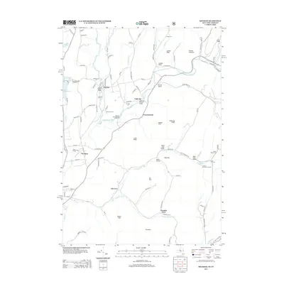
2013 Map of Shushan
USGS Topo · Published 2013About this map
The Batten Kill river winds through a valley defined by significant family landmarks and historical engineering, most notably the Shushan Covered Bridge and the Eagleville Covered Bridge. This landscape is deeply tied to its agricultural heritage, evidenced by numerous named farmsteads such as Hemlock Grove Farm, Flying Pigs Farm, and Windy River Farm. These sites, along with small settlements like Shushan, Eagleville, and Anaquassacook, reflect a long-standing rural community structure.
Find a feature on this map
102 named features on this map. Tap any name to fly to it.
Don’t see what you’re looking for? This feature index may not catch every label — zoom into the map to look around manually.
Map Details
Editions of this 2013 Shushan Map
This is the sole edition of this map. No revisions or reprints were ever made.
Other maps of this area

1894 · Equinox
USGS Topo · 1:62,500

1895 · Cambridge
USGS Topo · 1:62,500

1896 · Equinox
USGS Topo · 1:62,500

1897 · Hoosick
USGS Topo · 1:62,500

1898 · Cambridge
USGS Topo · 1:62,500

1898 · Bennington
USGS Topo · 1:62,500

1900 · Taconic
USGS Topo · 1:125,000

1900 · Equinox
USGS Topo · 1:62,500

1901 · Cambridge
USGS Topo · 1:62,500

1903 · Mettawee
USGS Topo · 1:125,000