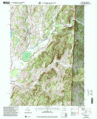
1995 Map of Shushan
USGS Topo · Published 2000About this map
Batten Kill winds through this landscape on the border of New York and Vermont, anchoring a region of small hamlets and rugged hollows in the mid-1990s. The settlement of Shushan and the nearby Eagleville are joined by several smaller named locales such as Pumpkin Hook, Ash Grove, and Anaquassacook, illustrating the dense rural community structure that persisted in this part of Washington County. To the west, Lake Lauderdale and the Eldridge Swamp break the terrain, while the eastern edge is dominated by the Green Mountain National Forest. This survey, revised by the USDA Forest Service, provides detailed locations for local landmarks like Bininger Cem, Camden Cem, and several numbered schoolhouses including School No 11 and School No 7. The juxtaposition of high ridges like Goose Egg Ridge and deep valleys such as Camden Valley highlights the topographic variation that defined local agriculture and transport in the late twentieth century.
Find a feature on this map
32 named features on this map. Tap any name to fly to it.
Don’t see what you’re looking for? This feature index may not catch every label — zoom into the map to look around manually.
Map Details
Editions of this 1995 Shushan Map
This is the sole edition of this map. No revisions or reprints were ever made.
Other maps of this area

1894 · Equinox
USGS Topo · 1:62,500

1895 · Cambridge
USGS Topo · 1:62,500

1896 · Equinox
USGS Topo · 1:62,500

1897 · Hoosick
USGS Topo · 1:62,500

1898 · Cambridge
USGS Topo · 1:62,500

1898 · Bennington
USGS Topo · 1:62,500

1900 · Taconic
USGS Topo · 1:125,000

1900 · Equinox
USGS Topo · 1:62,500

1901 · Cambridge
USGS Topo · 1:62,500

1903 · Mettawee
USGS Topo · 1:125,000